
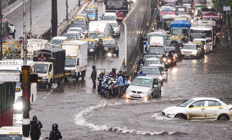
Mumbai has just had one of its wettest starts to July in years, packing nearly a full month’s worth of rain into the first seven days. The sheer intensity of it has left many wondering how this squares with El Niño a climate pattern that’s usually linked to weaker monsoons in India.
Nearly a Month’s Rain in a Week
The IMD’s Colaba observatory logged 791 mm of rain in the first week of July alone already surpassing what the station typically sees across the whole month. Santacruz wasn’t far behind, recording 879 mm against its usual July total of 919.9 mm.
The rain didn’t let up. Roads flooded, suburban trains were disrupted, and the city’s drainage systems buckled under the pressure, grinding daily life to a halt in several neighborhoods.
What Exactly Is El Niño?
El Niño is a naturally occurring climate pattern marked by unusually warm sea surface temperatures across the central and eastern Pacific.




India has historically felt its effects as a delayed monsoon and lighter-than-usual rainfall and this year started out following that script, with the monsoon reaching Mumbai nearly two weeks behind schedule.
Also Read:Mumbai Plans Scientific Tree Protection After Over 830 Trees Collapse In Monsoon Fury
But once it arrived, instead of settling into the steady, spread-out showers typical of the season, it dumped an extraordinary amount of rain in a short burst.
So Why the Heavy Rain Despite El Niño?
According to meteorologists, there’s no real contradiction here. El Niño may still be shaping when the monsoon arrives, but climate change is increasingly reshaping how it behaves once it’s here. Rainfall that used to spread evenly across weeks is now more often arriving in short, intense bursts fewer rainy days, but far more extreme ones. Put simply: the monsoon isn’t necessarily bringing less rain, it’s just delivering it in fewer, harder hits.
The Science Behind It
Here’s the underlying mechanism: warmer air holds more moisture. As global temperatures climb, both the atmosphere and the oceans are storing more water vapor than before.
That stored-up moisture doesn’t release gradually once conditions align, it comes down fast and heavy, rather than trickling out over many days. Mumbai’s own rainfall history backs this up. From 1981 to 2000, the city averaged around 2,325 mm of rain a year. Over the last two decades, that number has climbed by roughly 15%, to nearly 2,673 mm.
Two Weather Systems, One Massive Downpour
Experts point to a combination of weather systems working together, rather than a single cause. Warming over the Middle East shifted wind patterns in a way that pulled more moisture in from the Arabian Sea. At the same time, a low-pressure system sitting over the Bay of Bengal was feeding even more moisture into the mix.
When those moisture-heavy winds hit the Western Ghats, they had nowhere to go but up and that upward push over the mountains is what triggered such widespread, intense rainfall across Mumbai.
Rain Starting to Ease Up
After days of nonstop rain, conditions are finally calming down. For the first time in five days, daily rainfall dipped below 100 mm 94 mm at Santacruz and 90 mm at Colaba. The IMD still has a Yellow Alert in place for Mumbai, but the forecast points to lighter rain ahead, with Mumbai and neighboring Thane expected to see just light showers a bit of breathing room after one of the more intense monsoon stretches the city has seen this season.