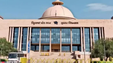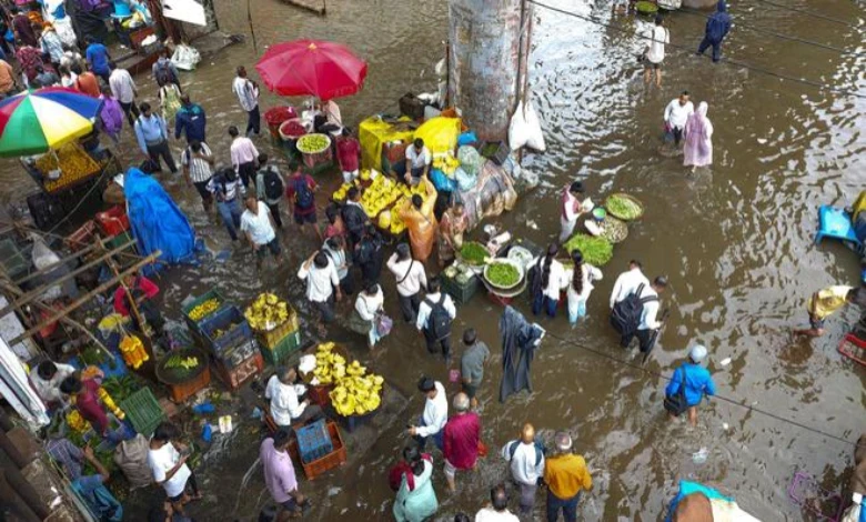
Ahmedabad: Gujarat is set for another spell of intense rainfall starting today, July 30, as four weather systems become active simultaneously across the state. The India Meteorological Department (IMD) has forecast heavy to extremely heavy rainfall over the next six days, with North Gujarat, Central Gujarat and South Gujarat districts likely to see torrential downpours.
The weather department has issued an orange alert for eight districts, including Surat, for today (July 30). For July 31, a red alert warning of extremely heavy rainfall has been declared for 13 districts, including Ahmedabad, Vadodara and Surat.
50 talukas record rain in the last 24 hours
Over the past 24 hours, 50 talukas across the state recorded rainfall ranging from 1 mm to 1.5 inches. The highest rainfall was recorded in Sanjeli in Dahod district at 1.38 inches, followed by Singvad at 1.06 inches and Lunawada in Mahisagar district, which also recorded around an inch of rain. Heavy upstream rainfall has left the Dholera region surrounded by water on all sides.
Schools shut in Ahmedabad and Vadodara
The IMD has issued a red alert for extremely heavy rainfall in Ahmedabad and Vadodara on July 31. All educational institutions in Ahmedabad and Vadodara have been ordered shut tomorrow as a precaution. Vadodara District Collector Anil Dhameliya has appealed to residents to stay safe, with the rain threat over Vadodara city and district expected to intensify from late tonight, July 30.
Weather Watch Group meets in Gandhinagar, administration put on high alert
A meeting of the Weather Watch Group was held at the State Emergency Operation Centre (SEOC) in Gandhinagar, chaired by Relief Commissioner Gaurang Makwana. The meeting carried out a comprehensive review of the state’s rainfall situation and the administration’s preparedness for disaster management.
The Relief Commissioner directed all coordinating departments to map their equipment and teams and remain in immediate action mode. He also instructed the Roads and Buildings Department to remove dilapidated structures and hoardings, and asked officials to take extra care in ensuring disaster alerts reach vulnerable populations living in kutcha houses and slum settlements in a timely manner.
During the review of the state’s uneven rainfall pattern and flood relief operations, the Relief Commissioner noted that Gujarat is witnessing a highly irregular rainfall distribution with Valsad and Navsari recording close to 100 percent of their expected rainfall, while Dholka has received an unprecedented 20 inches of rain in a short span. In view of this situation, all collectors and disaster management teams have been placed on high alert. Coordinated efforts by security forces have already ensured the safe relocation of over 53,600 citizens from South Gujarat ahead of flooding, while more than 9,600 people trapped in floodwaters have been successfully rescued.
Four systems active together, driving extremely heavy rain and red alert
Four rain-bearing systems are currently active over Gujarat at the same time: a deep depression, a monsoon trough, an upper air cyclonic circulation, and a Western Disturbance. These systems are expected to intensify rainfall from today onward, with the deep depression in particular strengthening the overall system.
Isolated extremely heavy rainfall is forecast today, July 30, across parts of South and Central Gujarat. On July 31, a red alert for extremely heavy rainfall has been issued for 13 districts, including Ahmedabad, Anand, Vadodara, Bharuch, Narmada, Surat, Tapi and Dang. Additionally, North Gujarat is likely to see heavy rain under an orange alert on August 1.
Also Read:Government Finds No Issue with Fuel Switch in Air India Boeing 787 Crash Probe
Fishermen warned for two days
According to IMD Director Dr. A.K. Das, a thunderstorm warning with lightning has been issued for the state until August 1. Winds over the sea are expected to blow from the southwest, with strong wind conditions driven by a sharp pressure gradient, reaching speeds of 20 to 25 knots. Due to the likelihood of strong winds, a warning has been issued for fishermen until August 1.
The four active systems and their impact on rainfall
1. Deep Depression
What it is: Weather systems intensify in a defined sequence — from a low-pressure area, to a well-marked low, to a depression, and finally a deep depression, before potentially developing into a cyclone. When wind speeds reach between 31 and 61 km/h and pressure drops significantly, the system is classified as a “deep depression.” It represents the stage just before a full cyclone.
Impact on rainfall: This is a highly powerful system that draws in intense moisture and cyclonic winds, causing extremely heavy to exceptionally heavy rainfall. The accompanying high wind speeds can uproot trees, block roads, and cause waterlogging or flooding in low-lying areas.
2. Monsoon Trough
What it is: A “trough” refers to an elongated belt of low pressure. During the monsoon, the low-pressure line stretching from Ganganagar in Rajasthan to the Bay of Bengal is known as the “monsoon trough.” When two such belts or branches — for instance, one over North India and another off-shore trough along the south or west coast — are active simultaneously, they are together referred to as two monsoon troughs.
Impact on rainfall: The monsoon trough acts as the primary “highway” for the monsoon. Moisture-laden winds from the Arabian Sea and the Bay of Bengal converge along this belt, resulting in widespread and extensive heavy rainfall. When two troughs are active together, the monsoon becomes highly active across large parts of the state or country simultaneously.
3. Upper Air Circulation
What it is: When winds begin rotating in a circular pattern slightly above the earth’s surface — typically at altitudes of 1.5 to 5.8 km — the phenomenon is known as an “upper air circulation.”
Impact on rainfall: This system draws in surrounding moisture-laden winds, leading to cloud formation and light to moderate rainfall, with isolated heavy rainfall in some areas. This system often intensifies further into a “low-pressure area” or a “cyclonic circulation.”
4. Western Disturbance
What it is: Unlike other systems, this does not originate over Indian land. It is a non-monsoon weather system that originates over the Mediterranean Sea, thousands of kilometres from India. It is pushed from west to east by the westerly jet stream winds at high altitude, entering India via Iran, Afghanistan and Pakistan. Because it arrives from the west and disrupts otherwise calm weather, it is called a “Western Disturbance.”
Impact on rainfall and weather: This system’s effects are primarily seen outside the monsoon season, mainly during winter and early summer.
Can also damage crops: When these moisture-laden winds strike the Himalayan mountains, they cause heavy snowfall in Jammu and Kashmir, Himachal Pradesh and Uttarakhand. At the same time, western states such as Punjab, Haryana, Rajasthan and Gujarat experience unseasonal rainfall, locally known as “mavthu.” If the system is particularly strong, intense wind gusts and hailstorms can also cause damage to crops.
-

-

-

-