
KOLKATA, October 30 — The fading fury of Cyclone Montha returned gloomy skies and steady downpours to Kolkata on Wednesday, as the once-fierce storm diminished further while pressing inland.
Heavy precipitation struck sections of the coastal districts, notably East Midnapore and South 24-Parganas. Having struck land along the Andhra Pradesh shoreline late Tuesday, the cyclone had degraded into a depression by Wednesday evening en route northward to Chhattisgarh.
The India Meteorological Department (IMD) anticipates the system’s lingering moisture to sustain wet conditions across West Bengal through Saturday. In the southern parts of the state, substantial rainfall is forecast for Birbhum, Murshidabad, and West Burdwan over the coming two days. Northern Bengal faces a more intense barrage, with projections of heavy to very heavy showers—ranging from 7 to 20 cm—in Darjeeling, Kalimpong, Jalpaiguri, Cooch Behar, and Alipurduar by Friday.
ALSO READ : Cyclone Montha: Deadly Strike Claims One Life, Forces Mass Evacuations
Alipore’s weather station logged approximately 8 mm of rain from Tuesday night through Wednesday night. In Calcutta, cloud cover is set to lift progressively, with drier weather anticipated starting Sunday.
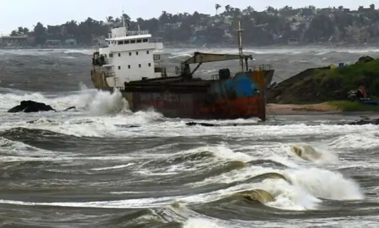
The cyclone crossed the coast between Machilipatnam and Kalingapatnam, south of Kakinada, impacting the Andhra Pradesh and Yanam shorelines—the latter a territory of Puducherry. At the point of impact, Montha qualified as a severe cyclonic storm, with sustained winds of 90-100 kmph and gusts reaching 110 kmph, according to the IMD.
Post-landfall, the system shifted north-northwest, traversing Odisha toward Chhattisgarh. By early Wednesday, it had dropped to deep depression status.
“Cyclonic Storm Montha, which was over coastal Andhra Pradesh, moved north-northwestwards at a speed of around 15kmph during the past six hours, weakened into a deep depression, and lay centred at 8.30am on Wednesday over coastal Andhra Pradesh and adjoining Telangana — about 50km south-southeast of Bhadrachalam (Andhra Pradesh), 110km east of Khammam (Telangana), 130km south-southwest of Malkangiri (Odisha) and 220km south-southwest of Jagdalpur (Chhattisgarh),” the IMD reported in an afternoon update.
“It is likely to move north-northwestwards across Andhra Pradesh and adjoining Telangana and south Chhattisgarh, and weaken into a depression,” the bulletin continued.
Forecasters expect the disturbance to further dissipate—from depression to low-pressure area, and ultimately to cyclonic circulation. Yet its northward path could draw it toward Jharkhand, Bihar, and Uttar Pradesh. “If that happens, there will be significant moisture incursion into Bengal, especially in north Bengal, which borders Bihar,” noted an IMD official in Calcutta.
Torrents soaked districts such as South and North 24-Parganas, East and West Midnapore, Howrah, Hooghly, Nadia, and East and West Burdwan on Tuesday and Wednesday. Off Digha, rough seas churned Tuesday night and Wednesday morning, leading local authorities to caution visitors against swimming.
In various areas, the relentless rains have inflicted damage on agricultural fields.
-

-

-

-

