Israel Army Apologises For Map Showing J&K As Part Of Pakistan
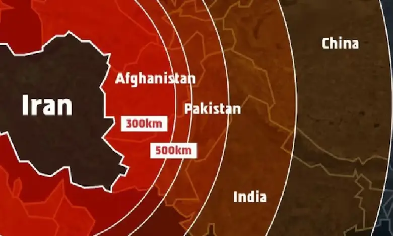
New Delhi : A day after the Israeli Defence Forces released a map illustrating the range of Iran’s missiles, which inaccurately depicted Jammu and Kashmir as part of Pakistan and Northeast India as part of Nepal, the military issued an apology on Saturday. The IDF posted the map on Friday, saying that Iran is a global threat and Israel is not the end goal, it’s only the beginning. We had no other choice but to act, it added, referring to the military offensive. The map also included India within the range of Iran’s missile range.
The IDF said, This post is an illustration of the region. This map fails to precisely depict borders. We apologise for any offence caused by this image. Several users on X raised their objections online. This representation has incorrectly depicted the entire map of India. The Union Territory of Jammu & Kashmir and Ladakh along with the States of Sikkim and Arunachal Pradesh are unquestionably integral parts of the sovereign territory of India and must be depicted as so, a user wrote in the community notes, with many others echoing the same.
Apart from India, 15 countries — including Russia, Ukraine, China, and Sudan, among others — fall within the range of Iranian missiles, according to the map shared by the Israeli forces. Israel on Friday launched massive airstrikes on Tehran, claiming the operation was aimed at dismantling Iran’s nuclear enrichment programme. The strikes reportedly killed several top Iranian military commanders and over 70 others, destroyed key installations, and left many injured.
Read Also : Modi Government Launches High-Level Probe into Air India Ahmedabad Crash