NASA has introduced an engaging way for people to connect with Earth’s landscapes through its “Your Name in Landsat” feature, launched as part of Earth Day 2026 celebrations. The initiative allows users to generate their names using satellite imagery captured over decades by the Landsat mission.
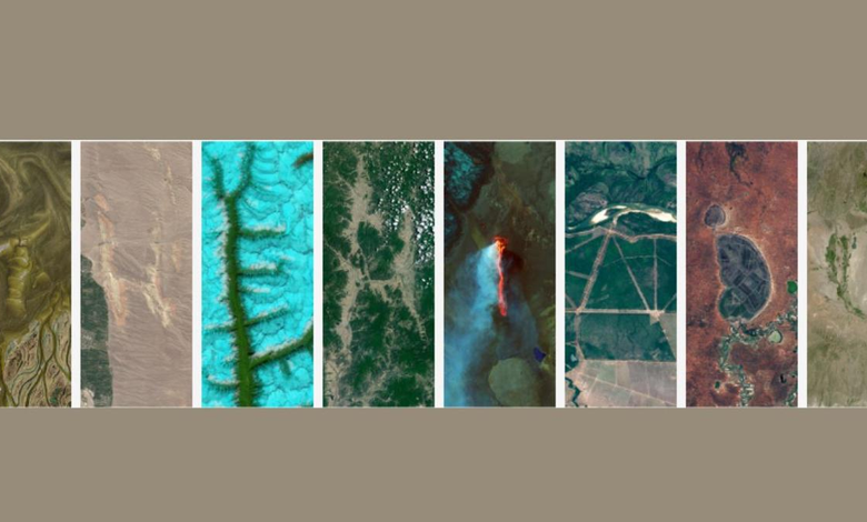
The tool works by identifying natural formations on Earth-such as rivers, mountains, coastlines, and deserts-that resemble letters of the alphabet. These images are then arranged to spell out a user’s name or any chosen word. The result is a personalized visual composition created entirely from real satellite data.
The imagery used in this tool is sourced from NASA’s extensive Landsat archive, which spans more than 50 years of Earth observation. NASA has collaborated with the U.S. Geological Survey (USGS) on the Landsat programme, making it one of the longest-running satellite missions dedicated to monitoring the planet.
The feature also provides an interactive experience, allowing users to explore the geographic origin of each letter. By hovering over the images, users can view details such as coordinates and locations, offering insight into the diverse terrains that make up the Earth’s surface.
The Hindu reports that the initiative is designed not only as a creative activity but also as an educational tool. It encourages users to engage with environmental science while appreciating the variety of landscapes captured from space. The project aligns with Earth Day’s broader objective of promoting awareness about the planet and its ecosystems.
Additionally, users can download or share their personalised creations, making it a popular digital activity during Earth Day celebrations. The initiative reflects NASA’s effort to combine scientific data with public outreach, fostering curiosity and a deeper understanding of Earth observation technologies.
Also Read: Gravitational Waves May Have Created Dark Matter in the Early Universe, New Study Finds
-

-

-

-