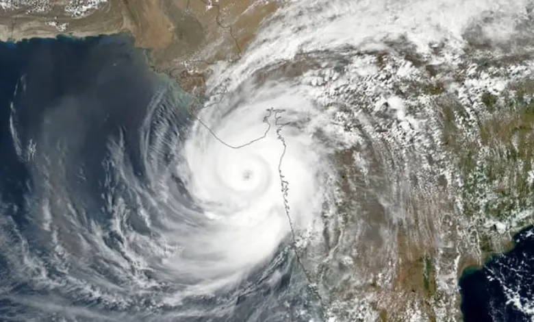
A deep depression brewing in the Bay of Bengal is poised to strengthen into a full-fledged cyclonic storm by Wednesday afternoon, prompting the India Meteorological Department (IMD) to issue urgent warnings for heavy rainfall across several southern states and island territories. If the system intensifies as forecasted, it will earn the name Cyclone Senyar, marking a potential early test for coastal preparedness in the region.
The weather disturbance originated as a low-pressure area near the Strait of Malacca and off Malaysia’s coast, evolving rapidly into a depression on Tuesday before deepening overnight. According to the latest IMD bulletin, the system’s core now sits at approximately latitude 5.1°N and longitude 98.5°E—roughly 160 kilometers east of Kuta Makmur in Indonesia, 200 kilometers west-southwest of George Town in Malaysia, 640 kilometers east-southeast of Nancowry in the Nicobar Islands, and 770 kilometers southeast of Car Nicobar. Over the past six hours ending Tuesday evening, it has tracked nearly westward at 10 kilometers per hour. IMD Director S Stella, speaking to the PTI news agency, affirmed that the depression will likely veer west-northwestward and build into a cyclonic storm later today.
Compounding the concerns, a separate low-pressure area has emerged over the southwest Bay of Bengal, adjacent to southern Sri Lanka and the equatorial Indian Ocean. Detected at 11:30 p.m. IST on November 25, 2025, this secondary system is expected to shift north-northwestward, maturing into a well-marked low-pressure area within the next 12 hours and possibly a depression in the following 24 hours, as noted in IMD’s recent post on X.
These dual threats have triggered a cascade of rainfall forecasts and advisories from the IMD, effective from November 25 through December 1. Southern regions face a barrage of precipitation, with heavy downpours anticipated in Tamil Nadu from November 25 to 30, Kerala and Mahe on November 25 and 26, coastal Andhra Pradesh and Yanam along with Rayalaseema from November 29 to December 1, and the Andaman and Nicobar Islands from November 26 to 29. Escalating risks include very heavy rainfall at isolated spots in Tamil Nadu on November 28-30, the Andaman and Nicobar Islands on November 26-27, and coastal Andhra Pradesh, Yanam, and Rayalaseema on November 30.


ALSO READ : Heavy Rains Lash Southern Tamil Nadu as IMD Warns of Thunderstorms in Chennai
Further amplifying the hazards, thunderstorms laced with lightning are highly probable over Tamil Nadu, Kerala and Mahe, Lakshadweep, coastal Andhra Pradesh and Yanam, Rayalaseema, and the Andaman and Nicobar Islands, often paired with the heavy rains. Gusty winds could whip up to 60 kilometers per hour in these areas. In coastal Andhra Pradesh and Rayalaseema, light to moderate showers are lined up for November 29, giving way to isolated heavy to very heavy falls the next day, with north coastal Andhra Pradesh potentially seeing pockets of heavy rain.
As of early Wednesday, November 26, 2025, at 7:59 a.m. IST, authorities in the affected zones are on high alert, monitoring the systems’ trajectories closely. The IMD’s vigilance underscores the need for residents in Tamil Nadu, Puducherry, Andhra Pradesh, Kerala, and the Andaman and Nicobar Islands to stay informed and prepared for disruptions from the impending weather onslaught.